Wherever you may be in the East Bay, you’re likely not far from an outstanding network of trails. Ranging from rugged and rocky footpaths to paved wheelchair and stroller-friendly routes, they all make their way through magnificent natural scenery.
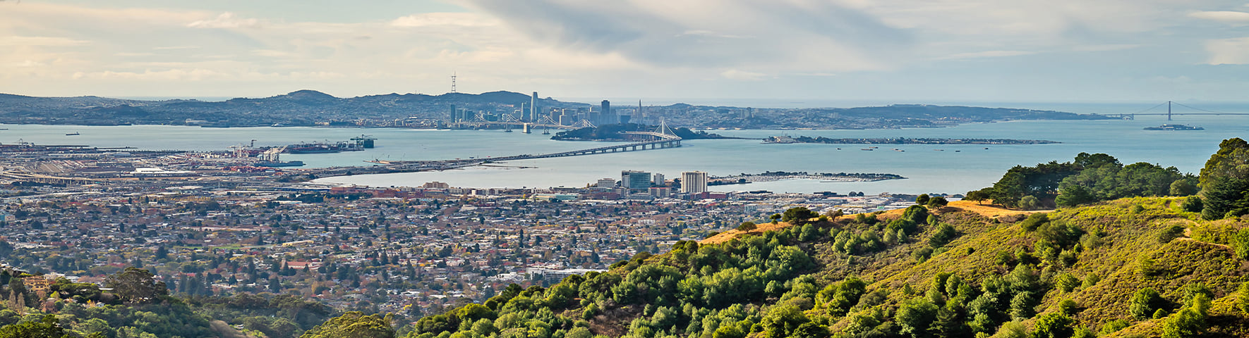
When trekking the hills to the east you’ll enjoy broad vistas of East Bay cities as well as the Bay itself. Many trails are maintained by the East Bay Regional Park District and East Bay MUD (yes, the water company).
Wandering closer to the Bay affords expansive waterfront vistas, phenomenal bird watching and a cooling breeze. Even our urban centers encourage access to nature. Oakland, Berkeley, Richmond, El Sobrante and others have great view hikes, many within the city limits.
A SAMPLING OF SCENIC EAST BAY HIKES
- Sibley Volcanic Regional Preserve features Round Top Peak (elevation 1,763 feet), an ancient volcano and the result of tectonic action between the Hayward and Moraga faults. There’s also an old quarry and a hidden labyrinth.
- Inspiration Point Trail is just one of many wonderful hikes in Tilden Regional Park. The route is paved and well-marked with amazing views at every turn.
-
The Big C Hike above UC Berkeley has an approximate elevation gain of 1,000 feet. The outlook is thrilling, encompassing the North Bay and San Francisco. An offshoot of the main trail will take you to Tightwad Hill where you can cheer on the Cal Bears from a free view of Memorial Stadium.
- Huckleberry Botanic Regional Preserve has an ecologically rich path that loops through a mature bay forest, then rises to a ridge where you’ll find views and native plants. These plants are relatively scarce and unique to areas such as this, where the soil and climate allow them to thrive. Because of the sensitive nature of this trail, dogs, bicycles and horses are prohibited.
- Sea Foam Trails offer great options for lovely hikes and picnic spots. Eucalyptus and oak groves, a wide variety of wildlife and birds, plus views of the San Pablo Dam and Reservoir make for a beautiful outing.
- Carquinez Strait Regional Shoreline has a number of multi-purpose view trails. From the hilltop you can see the marshland of Benicia State Recreation Area across the strait. From Franklin Ridge you’ll see Mt. Tamalpais to the west and Mt. Diablo to the east.
- Hayward Regional Shoreline Park encompasses 1,841 acres of marshes, seasonal wetlands and public trails. Hayward and San Lorenzo once engaged in salt production here, and at low tide, timber remnants at the landing sites emerge from the mudflats.
Have a favorite local hike? We’d love to hear about your East Bay excursions, so please reach out and share.